
The Laponia Triathlon is a long distance triathlon with 3860 m swim, 180 km bike and 42.2 km run. The maximum time to finish the race is 18 hours.
The start, T1, T2 and finish are all located in the same place at the Sandviken beach just one km away from Gällivare town center. You will receive three plastic bags which shall be used as bike-bag (T1), run-bag (T2) and finisher bag. You will place all three bags by your bike at the bike-rack and keep them there during the entire race. All your gear must be inside the bags during the entire race (with exception of bike helmet and bike shoes which can be on your bike).
Umara is our provider of energy during the race. We use Umara bars, gels and sports drinks. The Sports drinks are of Citrus flavor and mixed to a concentration of 360 kcal/liter. Gels are both with and without caffeine. Bars are of mixed tastes.
Swim 3860 m
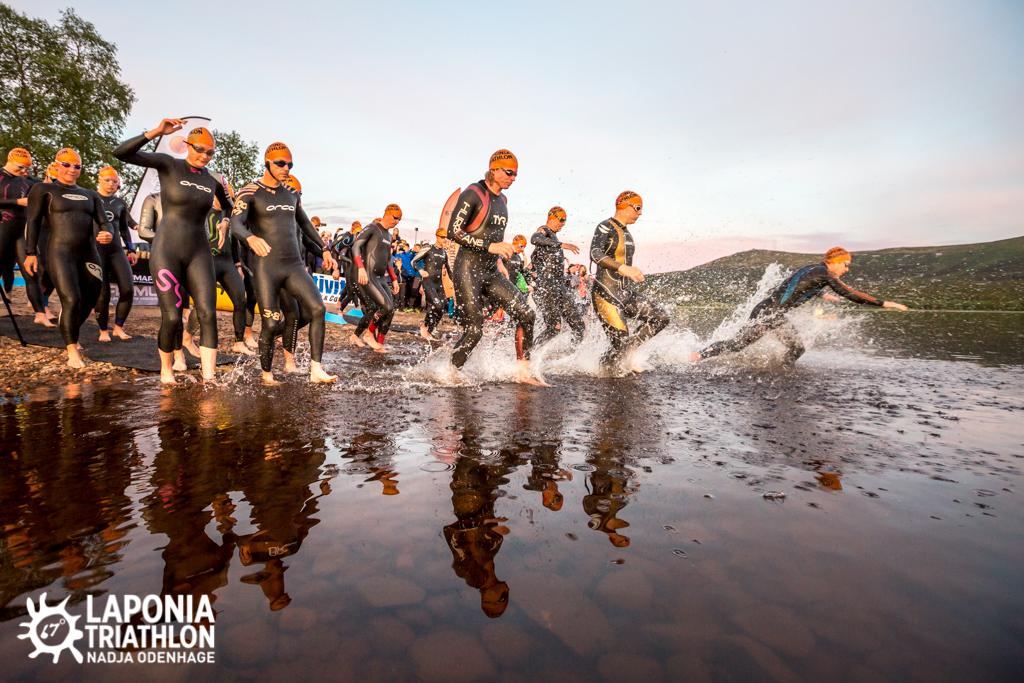
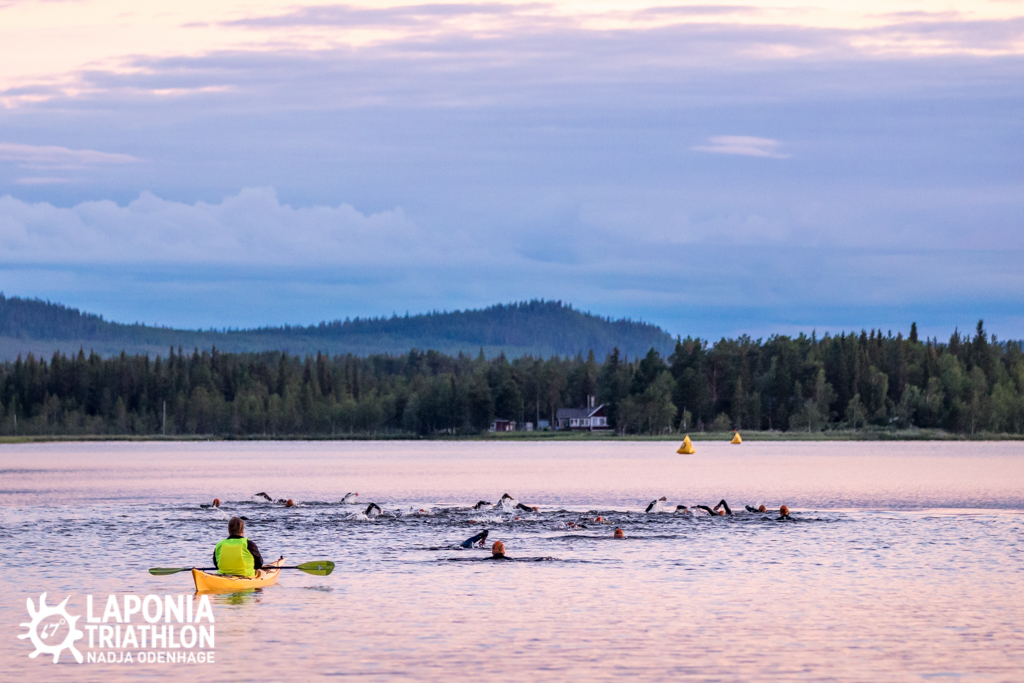
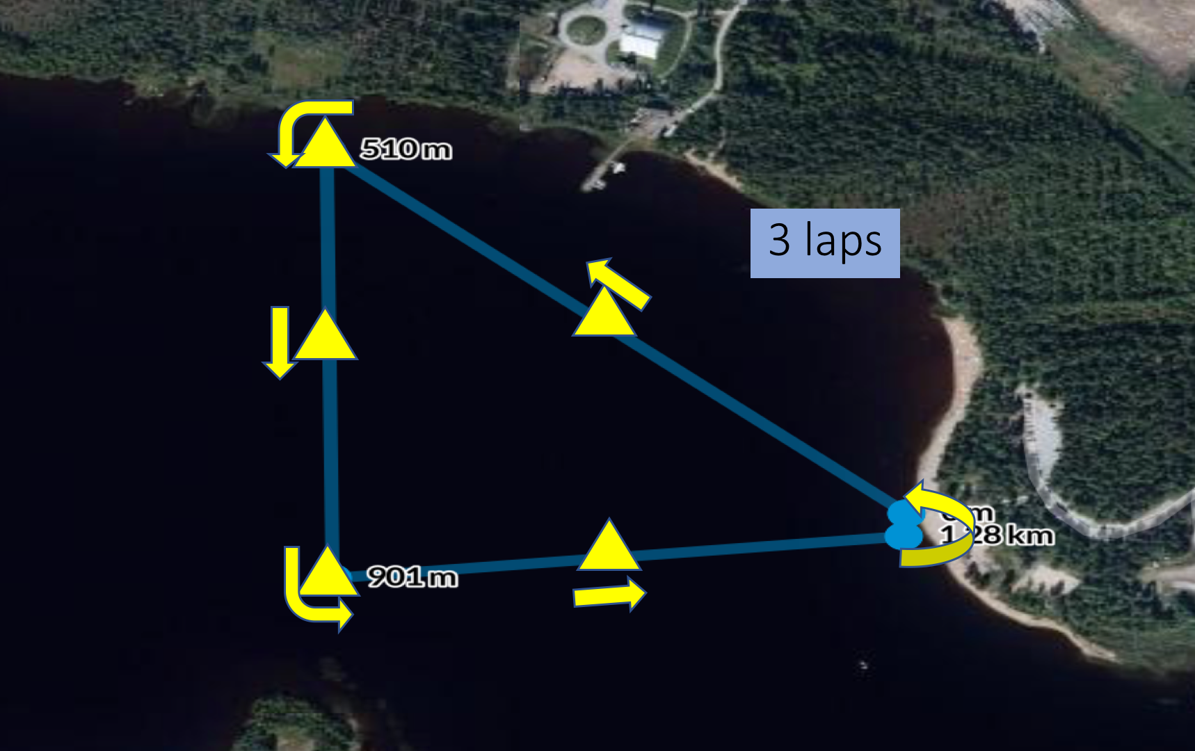 The swim is a three-lap course in lake Vassara which is located near the central parts of Gällivare. Between the three laps there is an Australian exit on the Sandviken beach which is a popular beach for swimming and other sports activities.
The swim start is at midnight but up here above the Arctic circle, the sun is over the horizon all night so there will still be daylight during the entire race. Water temperatures can vary quite a lot but colder than 15 degrees Celsius are uncommon as are temperatures above 20 degrees. The maximum time to finish the swim is 2 h 15 min.
T1 is next to the Sandviken beach, just a few meters away from exiting the water. All your race gear will be in your T1 bag by your bike and before you remove your bike from the bike rack all your swim gear shall be placed in the T1-bag by your place at the bike rack. All gear must be placed inside the T1-bag which shall be closed. The only things allowed outside the T1-bag are helmet and shoes which may be mounted on the bike.
The T1-bag will remain by your bike-rack position until you have finished the race.
Bike 180 km
The course is essentially a two-turning-point course with the first turning point up in the small village Tjautjas by lake Tjautjasjaure where the road ends and mountains start. After the turning point the course heads back to Gällivare and onwards to the village Nattavaara, (in)famous for being one of Sweden´s coldest places with frequent temperatures below -40°C. We do however expect warmer weather during the race but we will still provide a warming fire for the athletes in Nattavaara before heading back to Gällivare and T2 at the Sandviken beach. The maximum time to finish the bike is 11 hours (total race time).
The first kilometer on the bike will be on gravel bike paths and narrow roads taking you over the river Vassara to the ”Other Side” neighbourhood and on to the main road towards Gällivare town center.
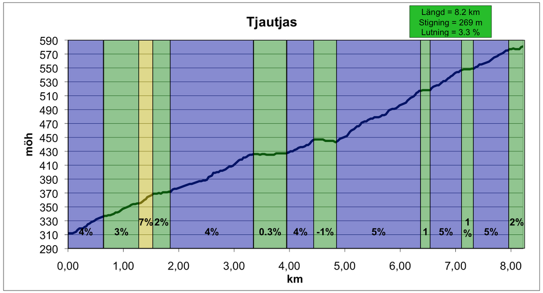 The road up from Koskullskulle to Tjautjas starts with an 8.2 km climb averaging 3.3%. After this the road to Tjautjas is undulating but no long or really steep hills. The turning point in Tjautjas is located where the road ends and you are surrounded by several mountain peaks above the tree line. Tjautjas is sort of a gateway to the swedish alpine world with Kebnekaise (highest mountain in Sweden) only 100 km of pure wilderness away.
Arriving back in Gällivare you turn left into the road to Nattavaara. The road is undulating but no long or steep hills. The turning point is located in small village Nattavaara. On the way back approaching Gällivare you see the Dundret mountain on your left.
Apart from the first (and last) km the rest of the bike course is on proper asphalt roads. The road surface is generally very good but there are some minor potholes on the 8 km downhill heading back from Tjautjas.
The roads are not closed for traffic but since the bike course is ridden during the night, traffic will be very limited. Still, all athletes must follow applicable traffic rules.
The total elevation gain is 1250 meters. The climb up to Björnfällan is 1.4 km at 6.7 % average but otherwise there are no steep long climbs. A gearing ratio of 39-28 (or 34-25) as the lowest gear should be sufficient for everyone.
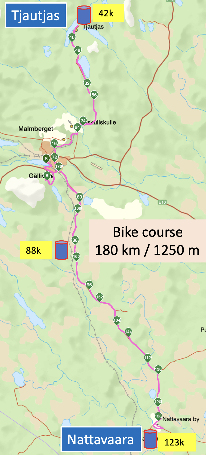
Overview of the bike course with the three aid stations.
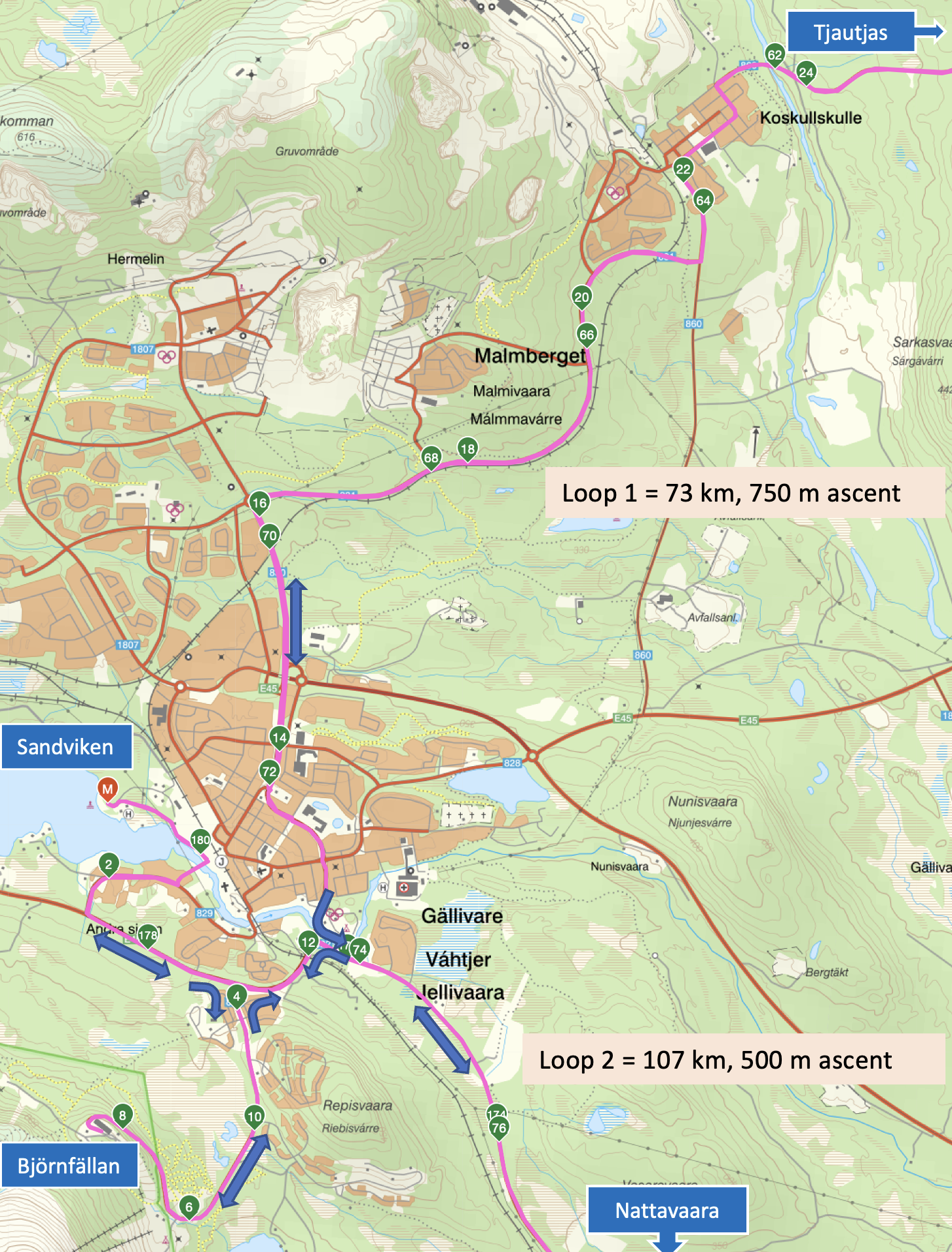
Start, loop and end of bike course.
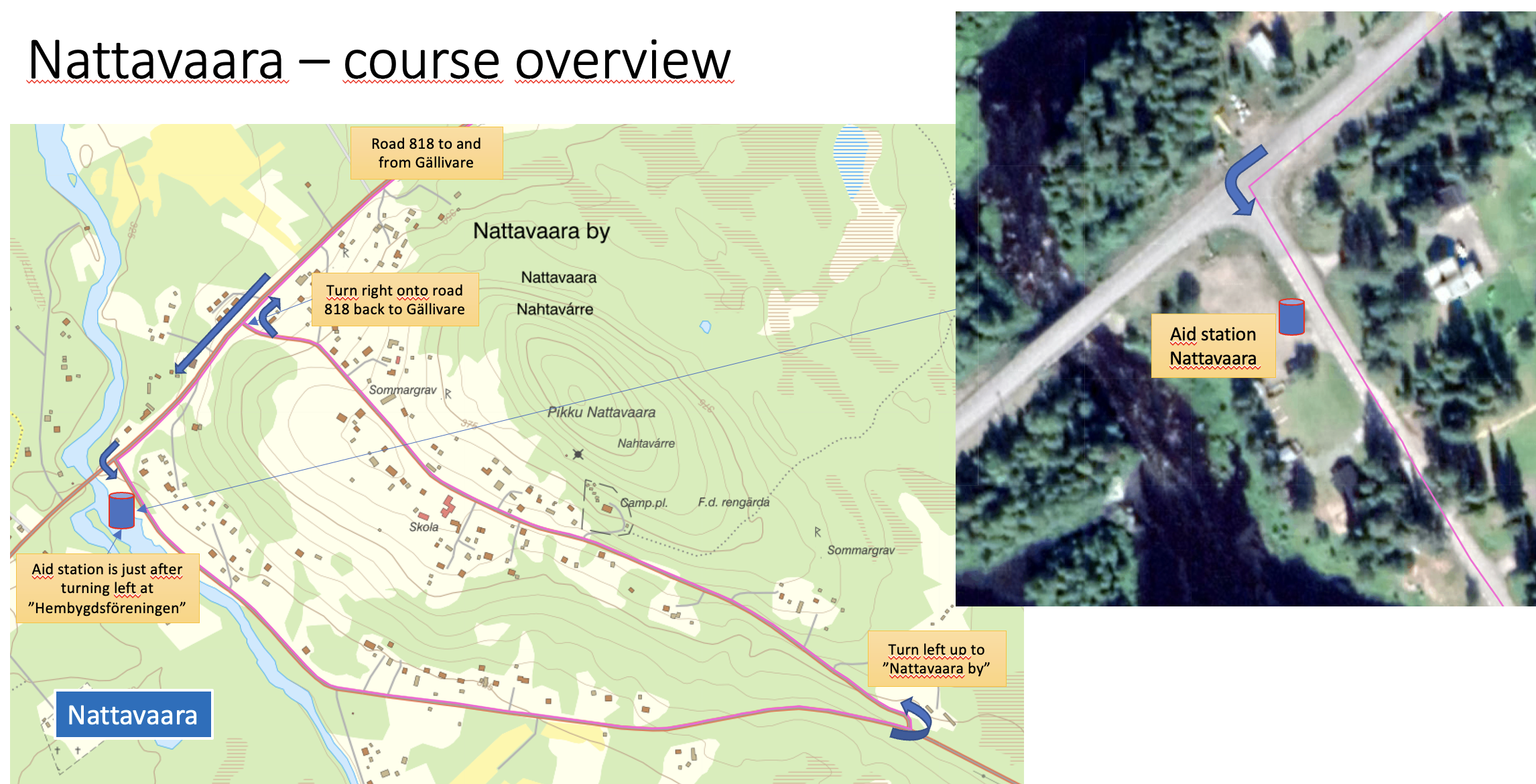
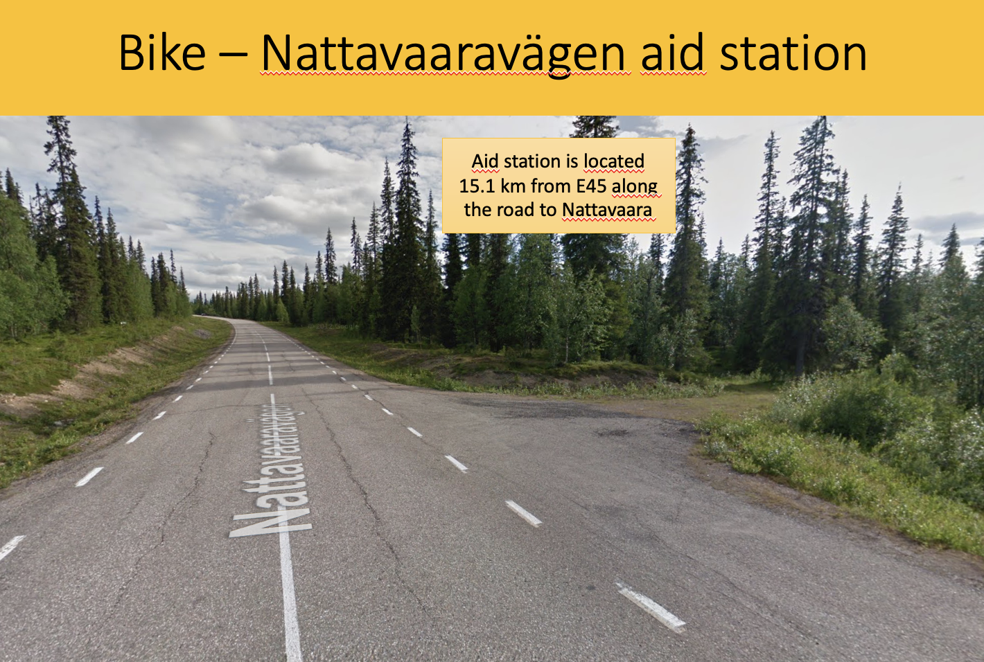
Nattavaara bike aid station and turn loop.
Wild life is rich along the course so even though traffic will be very limited you will have to pay attention to reindeers on the road. Bears and moose are also frequent in the area but are rarely seen on the roads.
T2 is located at the Sandviken beach (same place as T1). The surface in T2 is grass so you can leave your cycling shoes on your bike. When you enter T2 you first hang up your bike on your position at the bike rack. Then open your T2-bag which will be by your bike where you left it before the start. Change to your running gear, put all your bike gear back in the T2-bag and leave the T2-bag by your bike.
In T2 you can either change clothes in open air or inside the tents (one for women and one for men). Toilettes are available next to T2.
For more details about the bike course, check out the GPX-file. (save the file and rename it to *.gpx instead of *.xml). The GPX file is the latest update after the change due to roadworks which includes the Dundret Björnfällan climb.
Views from the bike course:
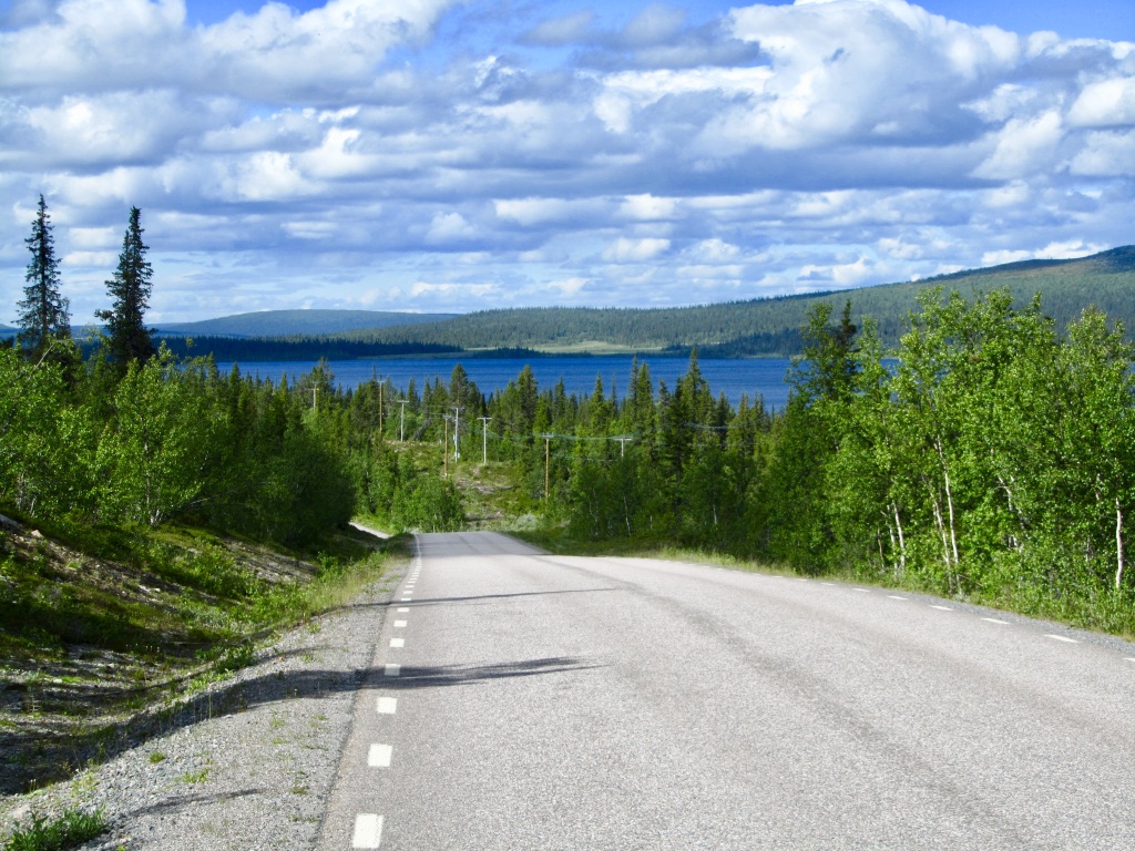
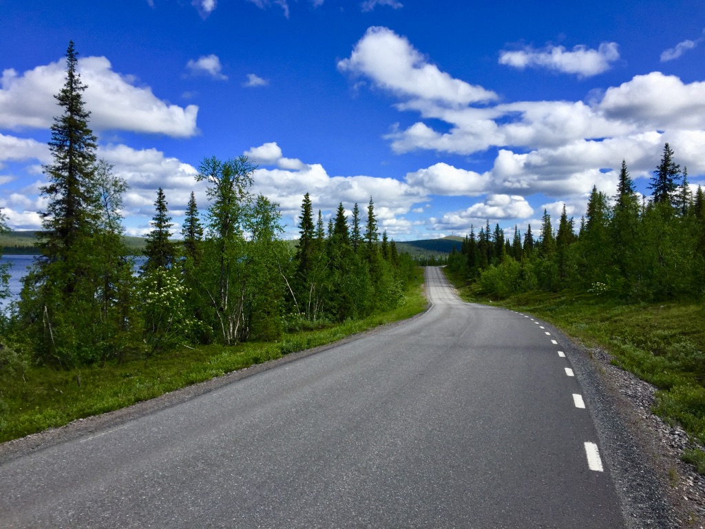

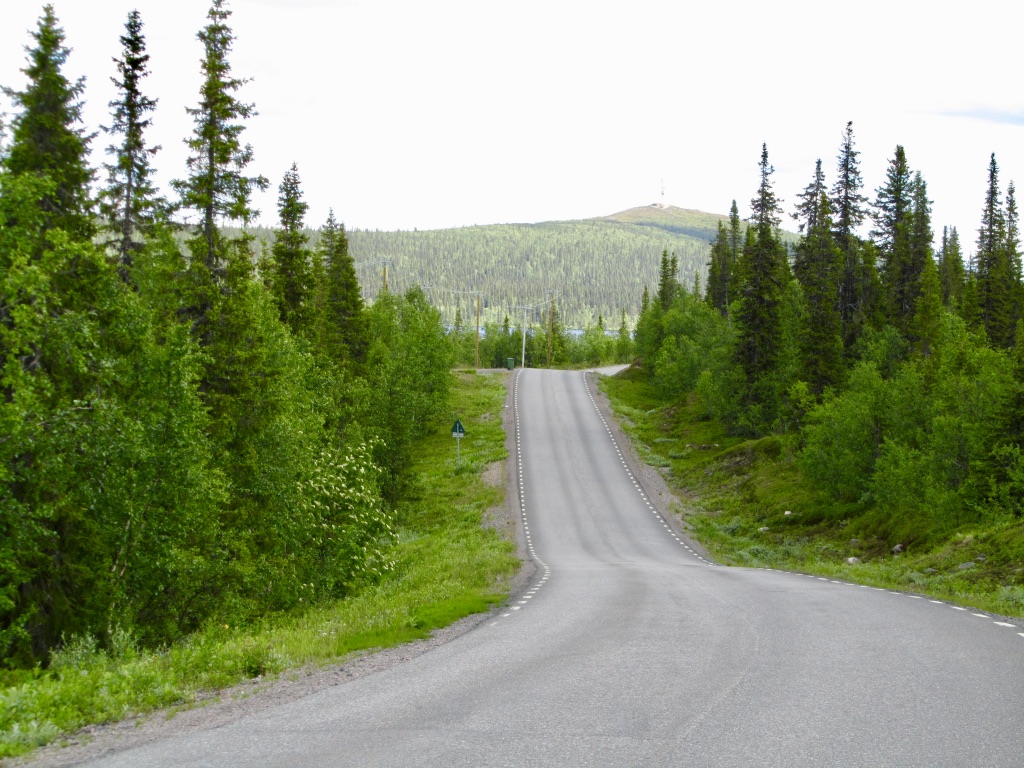
Run 42.2 km
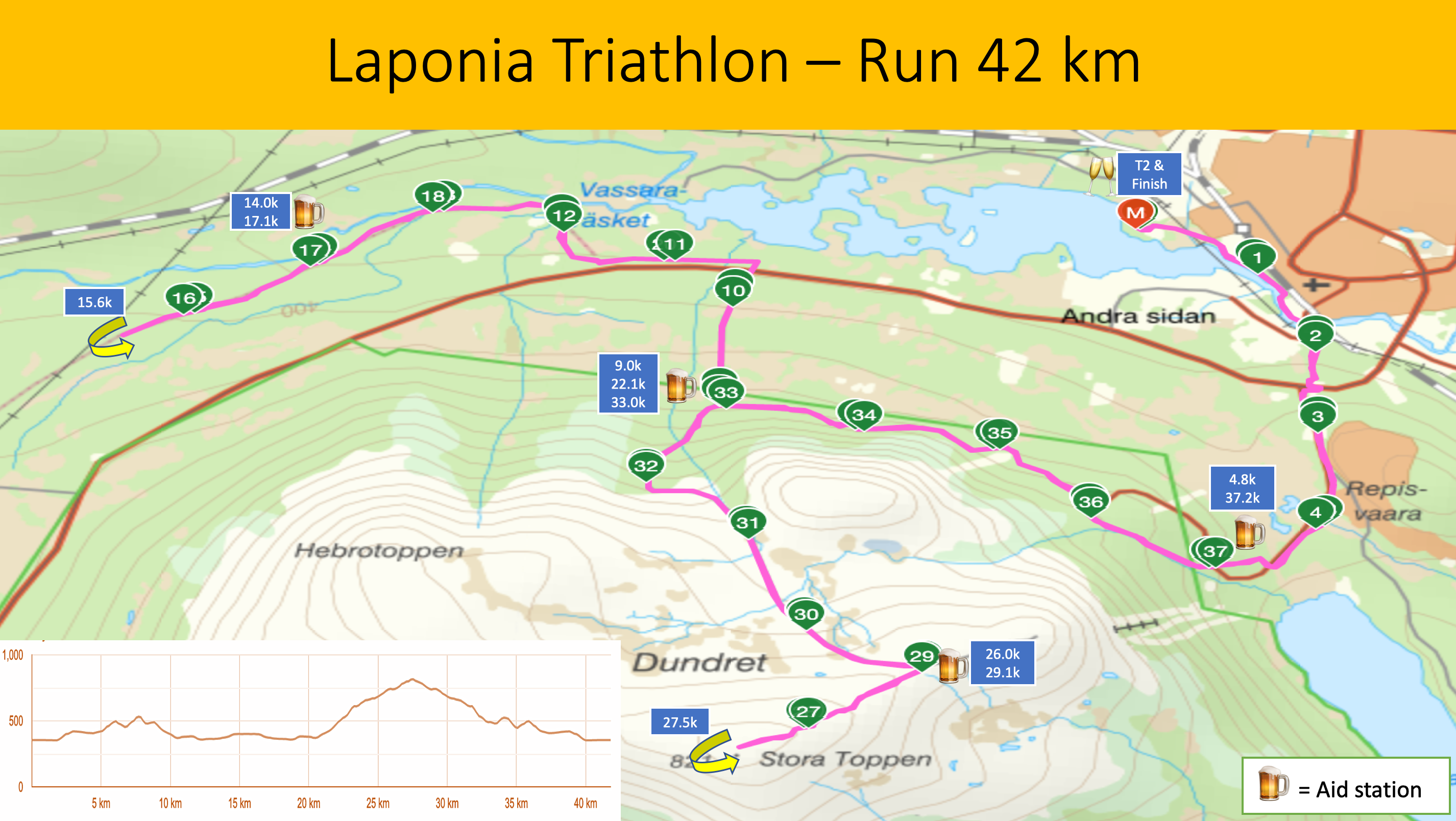
The run course starts in Sandviken and initially runs along the Vassara river with the Dundret mountain nearby. The name Dundret origins from the Sami word tuoddar. There are a couple of short but quite steep uphills on the way to the Hellner cross-country ski stadium where the first aid station is located. The stadium was named after the Olympic and World champion Marcus Hellner. After the ski stadium the course follows the base of the Mountain on a gravel trail for about 4 km and then turns right going downhill for 1.5 km to the national road E45.
Once down at the foot of Dundret the course follows E45 for about 1 km and then turns right into a gravel road heading towards Rallarstigen, a narrow trail in beautiful surroundings. The trail has been an important means of transportation ever since the 1700’s. Workers used to carry heavy loads as the water power plants and dams were being build. After about 3.5 km on Rallarstigen you make a U-turn going back on the same Rallarstigen track in the opposite direction.
Since Rallarstigen is run in both directions you will meet other athletes. Some short segments are narrow and in the unlikely event that you meet an athlete on those narrow segments you may have to stop and take a short step aside to be able to pass each other. Since the runners will be well spread out at this part of the race this will not be an issue to worry about but you still need to keep this in mind.
After 20.6 km the course turns right starting a long and tough climb up to the top of Dundret. You will follow the small paved road for 5.3 km and then turn right up a gravel trail for the final 1.6 km to the top and a total climb of 440 m over 6.9 km. You have to pass the aid station at 22.1 km before 14h30m of total race time to be allowed to continue the race.
The turning point is at the top, 823 meters above sea-level at the cabin ”Åke på toppen” from where you on a clear night and day can see one eleventh of Sweden’s surface. At this point you have less than 15 km to go and most of them are downhill.
On your way down you will have the impressive mountains of Sarek and Kebnekaise at the horizon. At 33 km you turn right, leaving the paved road and the last 9 km are on the same gravel trail and asphalt bike path as the initial 9 km of the run course. You reach the finish at the Sandviken beach after 42.2 km and 800 meters of elevation.
For more details about the run course, check out this GPX-file. (save the file and rename it to *.gpx instead of *.xml)
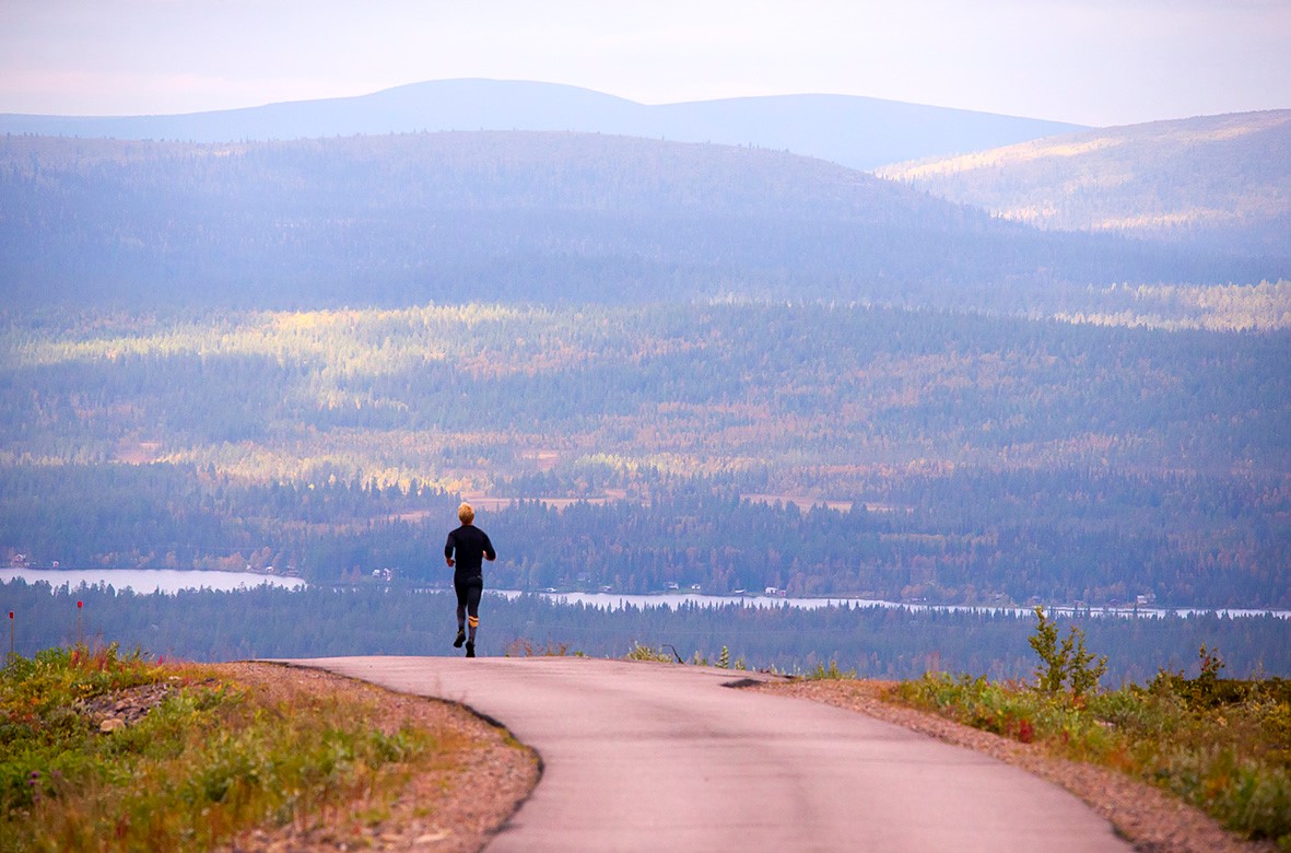
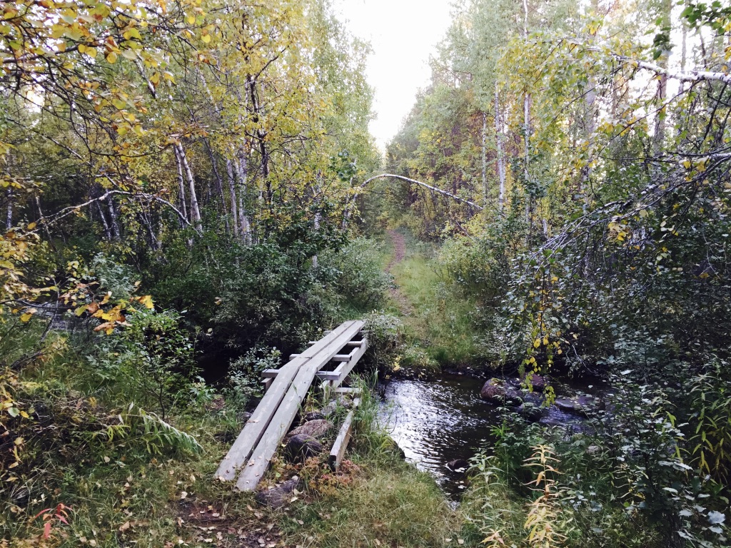
Views from the run-course:
(from left; gravel trail from Hellner ski stadium, running down from Dundret with Kebnekaise and Sarek mountains in the distance, the ”Åke på toppen” cabin in the winter, Rallarstigen trail)


Maps of transition area
The transition and finish area in Sandviken.